31 Jul Ptarmigan redux days 4-6
This is part two of my Ptarmigan-versary story. Five years ago this week, my friend Brenda and I completed the Ptarmigan Traverse in the North Cascades, after much dreaming and planning. This entry into my blog details days 4-6 of our adventure. Click here to read about the first three days.
“People usually consider walking on water or in thin air a miracle. But I think the real miracle is not to walk either on water or in thin air, but to walk on earth. Every day we are engaged in a miracle which we don’t even recognize: a blue sky, white clouds, green leaves, the black, curious eyes of a child — our own two eyes. All is a miracle.
”
As I stepped out of the tent on Wednesday morning the first thing that I saw was fog. The second thing that I saw was a small patch of blue sky – delicately hovering above the ridge behind us – the ridge where we wanted to go. “It’s clearing!”, I exclaimed. Brenda and I quickly broke camp and excitedly headed off towards the blue patch of sky. As we neared the ridge, the fog began to sag heavily and slowly, the blue patch faded into a grey oblivion, along with our hope for a clear day. From a saddle on the ridge we could see two possible routes : a scramble route on the ridge crest, and a possible route up a snow slope behind the ridge. First, we headed up the scramble route – it quickly dissolved from simple Class 3 scrambling, into more technical class 4 scrambling – not as easy as it sounds with a 40+ lb pack. We decided that the route seemed wrong, and so we headed back down to the saddle on the ridge. Next, we tried the backside of the ridge – we traversed along moderately steep slopes and loose talus rocks onto a snowfield, but we were unable to see the ridge due to the fog, and while the map appeared to suggest that the route would work, we weren’t 100% confident. Dejected, we returned to the saddle.
Back at the saddle, we suddenly heard the voices of the four climbers from Oregon that we had met the day before. We could immediately tell that they were attempting the scramble route up the ridge crest. After 20 minutes or so of sketchy exploring, they too retreated back towards the col. I intercepted them and described the backside of the ridge, which Brenda and I had previously explored. As we looked towards the possible route, the clouds parted momentarily, offering a sliver of hope that the slopes would provide access to the correct ridge. The group of four started ahead of us, and we followed in their footprints up the steep slopes to gain the ridge.
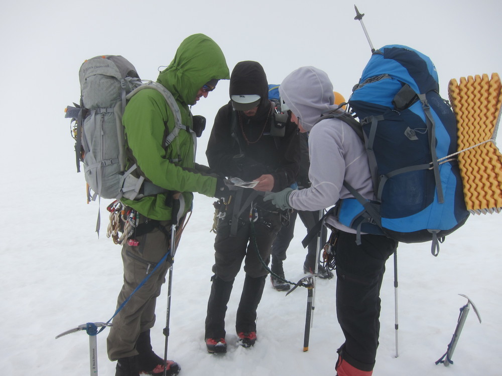
Checking the map in whiteout conditions.
Once on top of the ridge, there was an extreme sense of disorientation between what we felt like we had done (i.e. traverse around the rocky scramble part), and what we had actually done. The GPS told us to go one way, and our brains, with their faulty sense of direction, screamed that we needed to go another way. The visibility was horrendous, and as we followed the GPS to the next way point, we were overwhelmed with both frustration and the sense that we were hiking in circles. We found a small rocky outcropping and sat down – both of us were physically and mentally exhausted – we had no idea where we were, we couldn’t see anything around us and we started to worry about things that we couldn’t control – What if the fog never clears up? What if we never make it out? What will we do tomorrow?
The guys from Portland had chosen a higher route than we did, and soon we saw them backtracking (apparently due to a steep gully section that seemed improbable) down to our location. Moving together as a group now, we traversed steep snow slopes and slippery heather slopes – all in the interest of reaching the next GPS way point. I could tell that the morale of the entire group was relatively hopeless – one of the climbers stated to me, “I’m getting less and less excited about this all the time.” I felt the same way – it was scary, frustrating, disorienting and humbling all at the same time.
Finally, we came to a flat spot and after some consultation with the GPS coordinates and our maps, we determined our location. According to all of our sources, we were on track – heading towards the LaConte Glacier and the Sentinel-LaConte col. The topographic lines on the map were almost adjacent to each other – the terrain would be steep – cliff bands would impede our progress and we would have to determine the best way to navigate around them.
The next few hours were draining both physically and mentally – but we kept moving forward. With each step and each check of the map and GPS, our confidence grew. When the route finding began in the morning, I had felt certain that we wouldn’t make it to White Rock Lakes – but now, as we reached the base of the LaConte Glacier and saw peek-a-boo glimpses of LaConte Lake, I felt certain that we would make it to camp. Finally, we stumbled upon a barely-there track from a group ahead of us – success! As we headed up the glacier, the slopes were steep and unforgiving – we had been moving for nearly 10 hours and were driven at this point by fear and hope alone, as the point of being fatigued had long since come and gone.
In my dreaming and planning for the Ptarmigan Traverse, the South Cascade Glacier was one of the places that I was most looking forward to seeing. On the map, the glacier looks large compared to everything in the near vicinity – I couldn’t wait to see it with my own eyes. As we traversed above the glacier, however, we initially saw nothing, as it remained hidden in the thick fog. As we continued to traverse however, the fog started to dissipate. Little by little, the South Cascade Glacier revealed itself – it was one of the most spectacular glaciers I have ever seen – a nearly flat, massive expansive of snow, surrounded by towering auspicious peaks. So smooth, that it looked like it had been spread into the mountains with a giant butter knife – gentle ripples visible on its surface. One of the climbers from Oregon remarked that the South Cascade glacier seemed like, “a secret, hidden place” … and it was. It was a secret hidden place for us. At that moment, as the six of us plunge-stepped down towards the glacier, it meant so much more than it otherwise would have on a clear day. Despite the odds, we had made it – now all we needed to do was hike down the final steep slopes to the lakes.
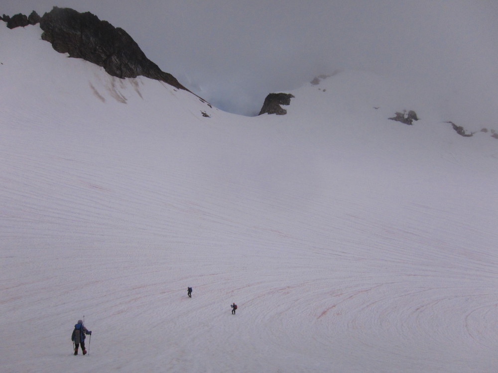
Dropping down onto the magical South Cascade Glacier.
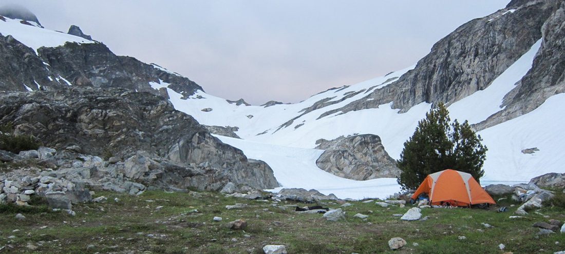
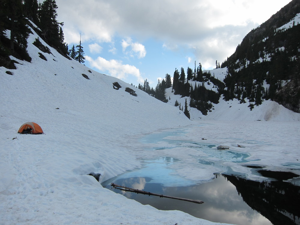
White Rock Lakes is one of the most fabled and sought-after campsites in the North Cascades. Seen by few, due to its extremely remote location, the lakes are perched on a ledge overlooking Dome and Sinister Peaks. As we arrived at camp I felt a mix of emotions – disbelief, relief, exhaustion and joy. White Rock Lakes is quite possibly one of the most beautiful places that I have ever been in my life – and, with the navigational issues experienced that day, it truly felt like a well-earned reward.
From camp, we could clearly see our route onto the Dana Glacier which we would be traversing the next day. Almost immediately, the relief of reaching White Rock Lakes was replaced by anxiety about our journey the next day. The route onto the Dana Glacier looked steep, foreboding and impossible. I took a zoomed in photo with my camera and tried to get my mind around what the next day would bring. Each day of the traverse so far had been far more humbling than I would have ever guessed – each day had tested all of our abilities : solitude, exposure, fear, mountaineering skills, navigation and patience.
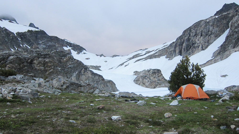
Our campsite at White Rock Lakes. Still one of my favorite places ever.
As I slipped into my sleeping bag that night, I reflected on the events of the day. After 12 hours of exhausting effort we had reached White Rock Lakes. The day was hardly the crystal clear bluebird day that I had hoped it would be, and yet, I didn’t feel that I had missed anything. Sure, we didn’t get the view that we had hoped for, but we were experiencing the mountains nevertheless in their natural state. In fact, the satisfaction gained from navigating in truly difficult conditions only seemed to enhance my appreciation and respect for the North Cascades. I savored the sense of security that I felt wrapped in my sleeping bag, knowing that the mountains were waiting for me the next day – ready to shatter any sense of false comfort with their ever changing moods.
Waking at White Rock Lakes and packing our bags to leave was bittersweet – it was hard to leave such an incredible place after such a short stay, but we knew that we had a long day ahead. We were both nervous about the looming journey and the seemingly impossible traverse onto the Dana Glacier. The sun was shockingly bright and the sky was clear when we departed camp. Almost immediately after leaving camp, we began an exposed traverse along an icy slope above a cliff. The snow was hard and it was difficult to kick in solid steps. I could feel my anxiety rising – starting the day off with a “no fall zone” less than 10 minutes after leaving camp seemed to be an ominous sign. As I plunged my ice axe into the snow for a self-belay, my right shoulder ached with the effort.
Now, I craned my neck towards the traverse up onto the Dana. While it had seemed almost impossible from camp, as we approached the route, the slopes looked less and less steep. When we finally reached the point to access the snow slopes up onto the glacier, I couldn’t believe it – these snow slopes were probably some of the most gentle slopes that we had encountered on the entire trip! What a relief it was to have a slight break from the mental exhaustion that comes as a result of traversing across constant “no fall” zones!
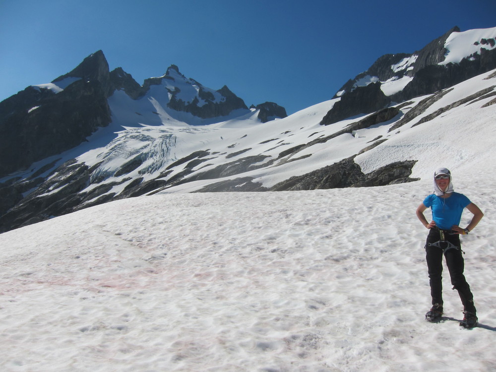
About to traverse onto the Dana Glacier, which was way more gentle than it looked from camp.
Brenda and I stopped on a smooth rocky outcropping part of the way up the glacier for a nice, long break. I took my boots off and massaged my bare feet on the warm polished rock. The sunlight drenched everything in sight and my heart and mind hungrily devoured the view – I couldn’t get enough of it. I had never been in a place so spectacular and so remote and untouched. I thought back to the first time I had ever read about the Ptarmigan Traverse – it had been almost 6 years prior, and I had seen a photograph of two climbers on the Dana Glacier. At that point in time, I could only dream about what it might be like to someday have the knowledge and experience to travel to complete the Ptarmigan Traverse. And now, years later, I was living my wilderness dream and sharing the experience of the Dana Glacier with Brenda.
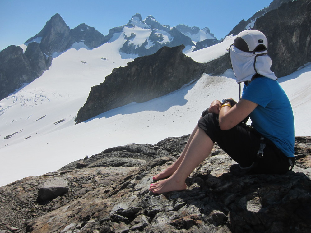
Enjoying a day that had only ever existed in my dreams before this.
Our day climbing up and over the Dana Glacier was a day that will always be a special memory to me. As we pushed further up the snowy slopes, I felt anxious for success, but hesitant for the experience to end. Our next landmark, Spire Col – at the top of the Dana Glacier, marked the “end” of the true traverse. From Spire Col, we would start our descent towards the Bachelor Creek drainage, which would ultimately lead us to the trail home. As the slopes of the glacier began to flatten out, and spire col came into view, I was overwhelmed – I don’t want it to end! I felt tears begin to well up into my eyes, and as they mixed with the sunscreen, my eyes began to cloud and burn.
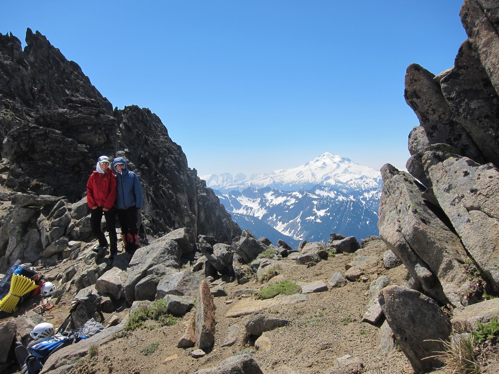
At Spire Col, about to start our two day descent back to the world. Glacier Peak looms in the background.
Reluctantly, we departed from Spire Col and after navigating some some steep snow slopes on the Itswoot Ridge, we made our way towards Cub Lake – our last campsite of the journey. The heat reflecting off the snow was intense, and as Brenda and I slogged towards the lake we were both feeling drained by both the physical demands of the day and the sun. Once at the lake, I melted snow (our Steri-Pen had failed the night before at White Rock Lakes) and enjoyed the quiet and the stillness of our last night in the wilderness. That night we ate (dehydrated) Lemon Cheesecake with a graham cracker crust for dessert. It was the first night of the entire trip that I was finally able to enjoy my dinner and dessert, as my stomach was not twisted with nervous anxiety.
Final campsite of the traverse at Cub Lake.
Our last night on the traverse. I could hardly believe that tomorrow our journey would end. Part of me was anxious to get home so that I could tell my family about our adventures and, of course, take a much needed shower. The other part of me was not ready to let go of the stillness and solitude that we had found in the North Cascades. Each day was truly an exercise of living in the present moment – an experience that most people are not familiar with as they go through their busy lives constantly worrying about work, money and responsibilities. Our days, while sometimes frightening or difficult, had been simple – breathe, drink water, eat, walk. Focusing on one step in front of the other, the sense of time had faded into oblivion and we went for hours immersed completely in the present.
Our 5th day in the Cascades was perfect in every sense of the word – crystal clear azure skies, glistening glaciers, towering auspicious peaks and fun climbing in one of the most spectacular locations I have ever been. The frustration felt during our poor visibility days, drifted away – just as the clouds had cleared and revealed the secrets that they had kept hidden. Each day on the traverse thus far had revealed a new aspect of the North Cascades and helped to shape our experience into an inclusive understanding and respect for the mountains which we admired and loved. With only one day remaining on our traverse, we drifted to sleep – both excited and sad for the adventure to come to a close.
“There is a magnet in your heart that will attract true friends. That magnet is unselfishness, thinking of others first. When you learn to live for others, they will live for you.
”
The last day of the traverse started with a sketchy climb up to Cub Pass from Cub Lake. I wasn’t expecting yet another “no fall” zone, but as we kicked steps into the steep, icy slope – I was very aware that a fall here would either mean, A) serious injury, or B) serious injury and sliding into the freezing waters of Cub Lake. Both options were out of the question – and so, carefully, Brenda and I made our way up to the safety of Cub Pass. Once at the top of the pass, we began our descent into the Bachelor Creek drainage.
The Bachelor Creek drainage is a notorious bushwhacking route, which ultimately leads to the Downey Creek Trail (which leads to the Suiattle River Road…. which is where our bikes were stashed so that we could get back to the car). From the SummitPost.Org website, a brief description of the bushwhacking is as follows :
“My partner and I had a mini-epic on that descent, which could have easily been avoided. We took a wrong turn in the alder, and paid dearly. We traveled about a mile through all kinds of crap… numerous bee hives, overgrown rock slides, pure hell. We finally got smart enough and found the trail on the other side, just before a never-ending sea of the thickest alder I’ve seen.”
The beta that we had collected prior to our trip gave a brief description of how to exit the drainage in order to find the Downey Creek Trail : “go around that bend in the creek, cross to the S, descend into Alder Hell, fight it for a while, find a path back to the creek, and cross on a log to find a perfectly good trail on the N side.” We found the bend in the creek, but due to sketchy snow bridges, we were unable to access the south side. We started descending the north side of the creek – navigating dense brush and steep snow amidst forested terrain. Soon, having been sufficiently mauled by every low hanging evergreen branch in the Bachelor Creek drainage, we found our way to a forested area with a mild understory. We were slightly concerned about finding our way back to the other side of the creek – and so we made our way in that direction, climbing up and over dozens and dozens of downed trees – much easier said that done with our large packs.
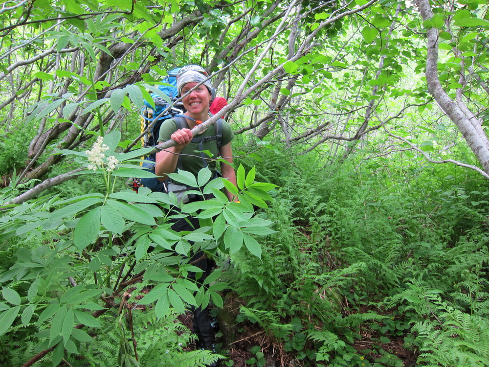
Enjoying some fun ‘schwacking down the Bachelor Creek drainage.
To our surprise, and delight, when we finally reconnected with the Bachelor Creek, we crossed over it just below the large slide alder patch that the trail description had mentioned. The bushwhacking on this trip was nowhere near as difficult or as mentally taxing as the bushwhacking that Brenda and I had encountered on our Silver/Abiel/Humpback traverse the previous month. Bushwhacking is more of a mental game than a physical one : the mental exhaustion that comes as a result of navigation through difficult/challenging/ridiculous terrain can be both frustrating and demoralizing. While bushwhacking the Bachelor Creek drainage was certainly not easy, both Brenda and I felt that Silver/Abiel/Humpback excursion had mentally prepared us for the tediousness. Working together, we picked our route through the hundreds of downed trees that attempted to stand in our way. Finally, we found a small trail, and eventually, the log that would lead us back to the north side of the creek – and hopefully to a real trail.
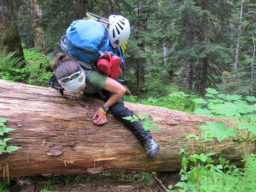
Just a little log hopping.
Once we crossed over the log, we used pre-programmed GPS waypoints to help us pick our way through the forest. Finally, we stumbled across what slightly resembled a trail. The next several miles were hiked upon what is perhaps the most overgrown/brushy trail that I have ever seen. We were brutally assaulted by plants of all types, and the vegetation was so thick that I couldn’t see my feet, or the ground, which resulted in a multitude of falls and slips.
After several miles of exhausting brushy trail, we finally made it to the Six Mile Camp, which marked the start of 6.6 more miles down to the Downey Creek Trailhead. My feet were aching, and I cringed with the realization that, including our bike ride from Suiattle River Road to the car, we still had over 15 miles to travel. Brenda and I sprawled out on the ground and enjoyed a snack before re-hoisting our packs for the final push.
Once on the Downey Creek Trail, I found myself in a state of “climber auto-pilot” – numb to the pain in my feet and the exhaustion in my legs. The Downey Creek Trail, in true North Cascades fashion, seemed to have more ascent than descent – the North Cascades is truly the only place were I would expect to gain elevation while descending a creek drainage. As we plodded down the trail, and as time slipped by, I felt slightly panicked by ridiculous and improbable “what-ifs” – What if this wasn’t the right trail? What if we had to back track? What if the trail led us to a place other than the Suiattle River Road? I’m not sure why I felt uncertain – perhaps it was as a result of fatigue, or perhaps due to the lingering fear that we wouldn’t be successful. I regained my confidence after a quick GPS check, and we continued up the merciless slopes down the Downey Creek drainage.
With each passing step, I became acutely aware that we were nearing our destination. Each bend in the trail seemed to bring hope that the next bend would reveal the end of our hike. I had dreamed of this particular moment for so long – and here it was. We rounded a corner, and my eyes caught a glimpse of something that was out of place with the towering Douglas Fir trees – some plywood with a small peaked roof … a trailhead sign! I desperately wanted to say something to Brenda – I wanted to capture what it meant to me to be (safely) at the end of this journey with her, but I couldn’t find the words. Even if I had found the words, I don’t think that I could have spoken them – instead, I turned around towards her and smiled. She smiled back at me. I held onto that feeling and that smile as we took the final steps off the trail and onto the Suiattle River Road. I hold onto that feeling now, and every day, as I recall our adventure on the Ptarmigan Traverse and the friendship we have that made the journey so special and meaningful.
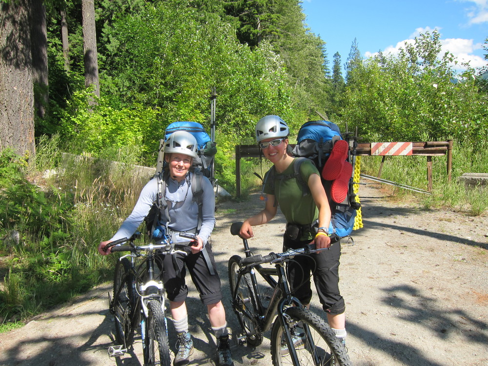
Nine miles remained on our journey. Excited, we retrieved our stashed bicycles – relieved that they were still in the location that we had left them nearly two weeks prior. Wobbly, we mounted the bicycles and began the ride back to the car. Our backs ached with the weight of the pack, and each slight incline was a true test of stamina and patience – biking with a pack on is not easy.
Having biked and jogged the Suiattle River Road two weeks prior on our bike-stashing trip, we were familiar with the terrain. As the gate marking the road closure came into view, I felt a sense of joy and disbelief. There were so many times on the traverse when I had been afraid : afraid of falling, afraid of dying, afraid of failure, afraid of weather conditions. And yet, as we arrived at the car, any trace of fear or uncertainty dissolved and transformed into pure, blissful happiness. Six days together, 40 miles and over 13,000′ elevation gain through rugged, dangerous terrain. While planning for the Ptarmigan Traverse, I had expected it to be an awe-inspiring, challenging adventure that would grant me access to views of some of the most spectacular mountains in Washington State. The reality of the Ptarmigan Traverse is this : the mountains are nothing, compared to the friendship experienced by the climbers who seek them. For me alone, the mountains would amount to a heap of rocks and snow – dangerous conditions and unspeakable physical challenges. For Brenda and I together, the mountains were a visual representation of our indomitable spirits and the glaciers were a reflection of the inextinguishable adventure spark in our eyes and hearts. The difficult conditions experienced wanted to tear me apart, but together, we worked to push beyond them towards safety and success. Upon completion of the Ptarmigan Traverse, I know that the true adventure – our friendship and our unified desire to climb and explore – will never end.
Five years ago this week, we completed the Ptarmigan Traverse.
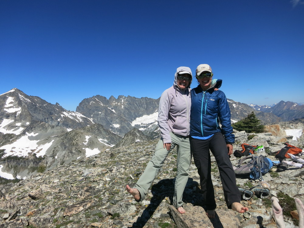
And here we are 5 years later (just last week!) on the summit of N. Spectacle Butte. Still climbing, still crazy and still friends.
No Comments