30 Oct Wind River High Route – Day 7 – Did I mention the rocks?
“Adieu to disappointment and spleen. What are men to rocks and mountains?”
After a half-day rest and a good night’s sleep, we woke up on day 7 feeling (somewhat) refreshed and rejuvenated – well, as much as one can feel rejuvenated on the High Route, at least. We were awake, I was able to eat my breakfast bar, and all of our limbs were functioning – the benchmark of a successful morning. We started early in the morning, so that we could ascend Blaurock Pass before the heat of the day made the climb more unbearable than necessary. According to our annotated map, Blaurock was the steepest climb on the entire route – gaining about 2000′ in 1.2 miles – ouch. While I’ve done many hikes/climbs with a 1000’/mile gain, it is worth noting that Blaurock pass sits at 12,750′ elevation – which basically means that we were out of breath walking on flat terrain before we even got to the climb. I could already tell that It was going to be a good day.
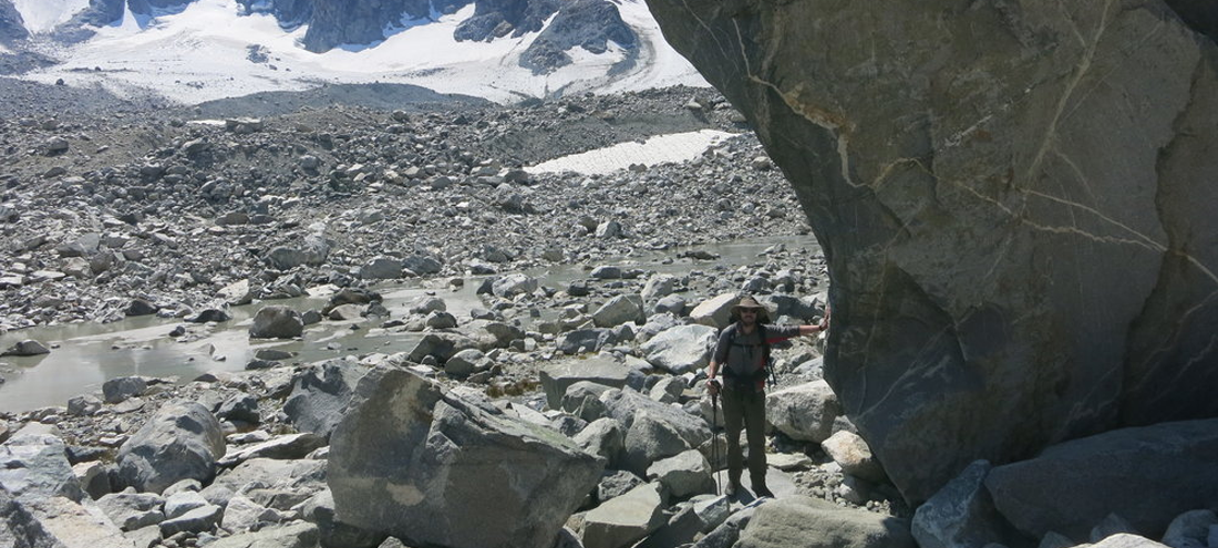
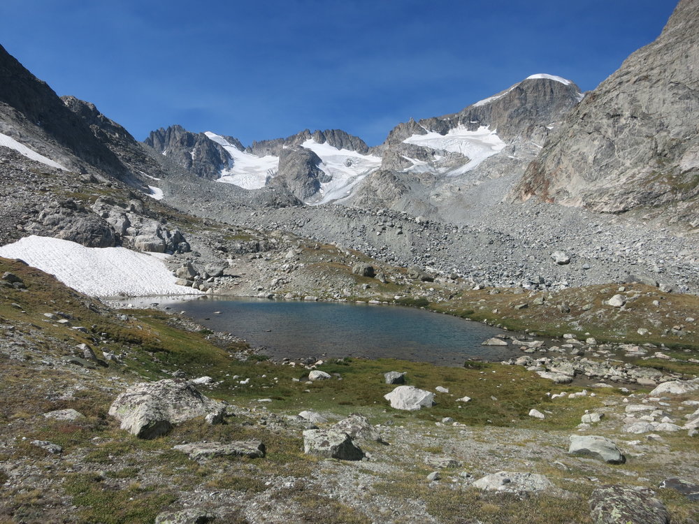
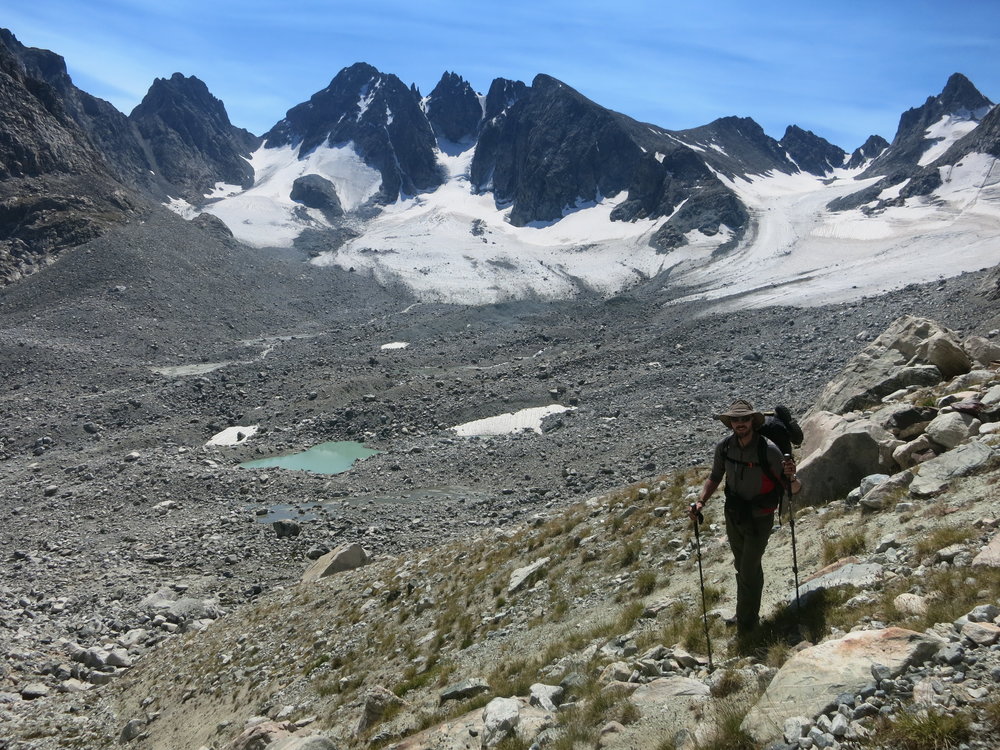
Flood plain below Blaurock Pass (upper right of photo).
Looking down on the flood plain from our ascent to Blaurock Pass. The first part of the climb is relatively easy, on some nice tundra.
As we plodded up the slope, the smooth, easy tundra started to become more and more rocky. Before long, we were climbing on medium sized rocks. Eventually, we transitioned to larger boulders. Finally, we found ourselves tediously picking our way through Honda Fit sized boulders. (Author’s note: I’m not sure who decided that the VW Bug should be the benchmark size of a large boulder, but I’m taking some creative liberty with this longstanding tradition, and moving into a more reliable, fuel-efficient vehicle to set the new gold standard for boulder sizing). The rocks looked stable, but the route finding was extremely stressful, as some of the rocks would silently “wobble” upon even the slightest touch. We painstakingly tested the rocks as we progressed upwards – desperately hoping that we wouldn’t disturb any of them enough to cause a catastrophic event – I cringed thinking about the effects of even a slight “budge” of a 4000lb boulder. In addition to the size of the rocks themselves, they were positioned strategically in such a way that there was a seemingly endless abyss of death below all of them – again, I tried to distract my mind and avoid thinking about getting stuck for all of eternity in a boulder chasm. I focused on every movement, every step, every hand placement – I tried to stuff my fear away at the bottom of my pack, but it only seemed to make my pack heavier. Eventually, I found an uncomfortable middle ground – pure terror at what could happen, but absolute focus so that it didn’t happen.
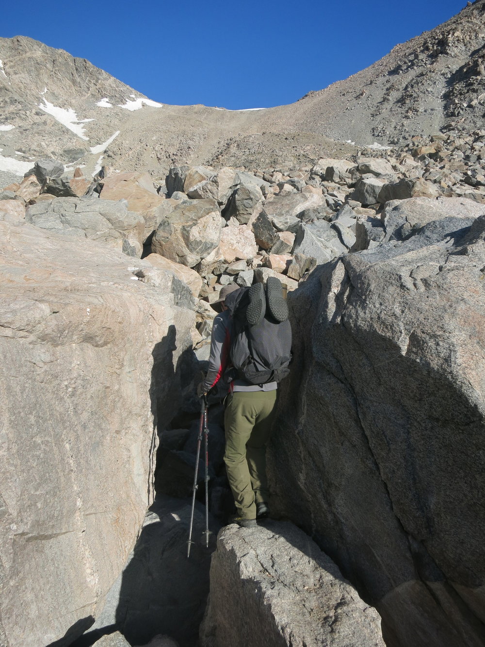
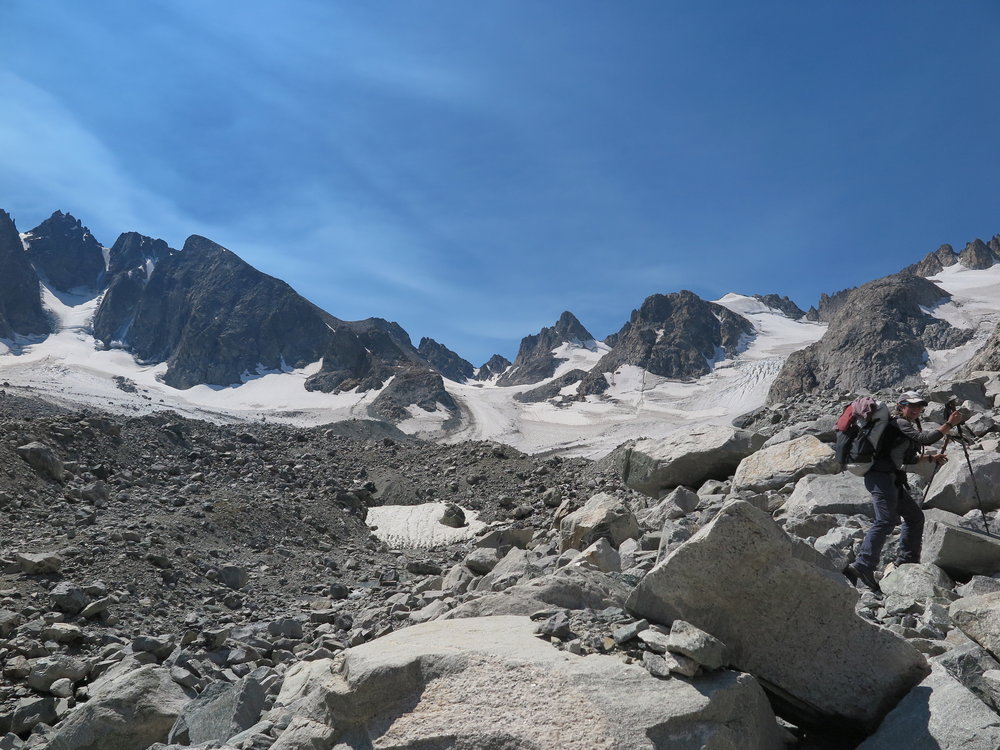
Navigating more rocks. Blaurock Pass in the distance.
A tame section after a very messy moraine, en route Blaurock Pass.
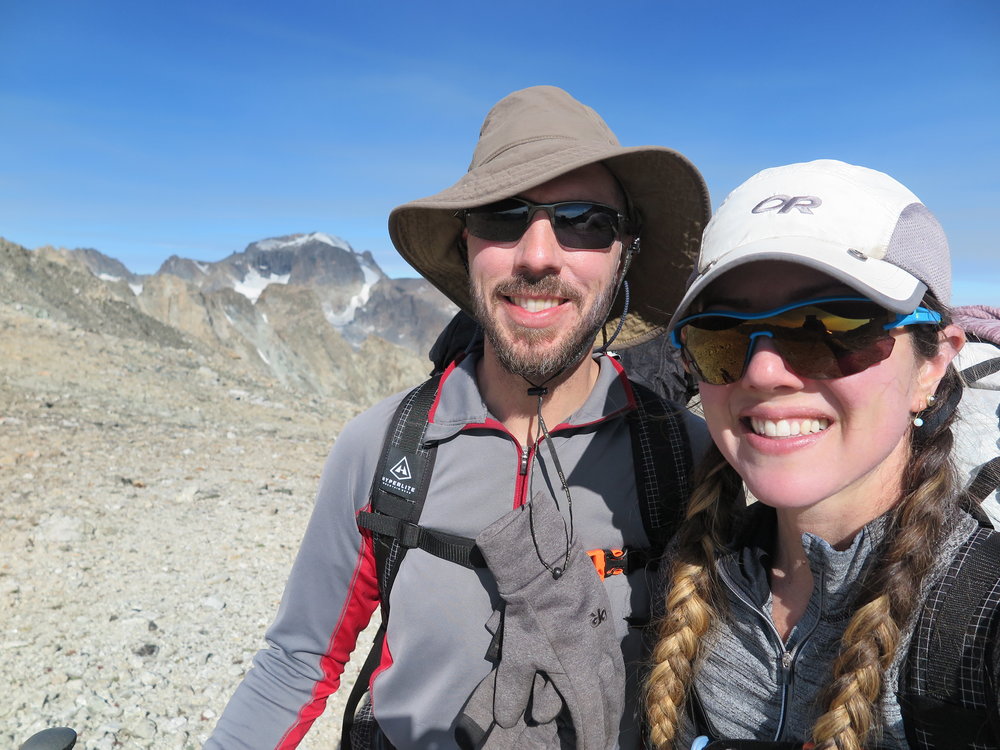
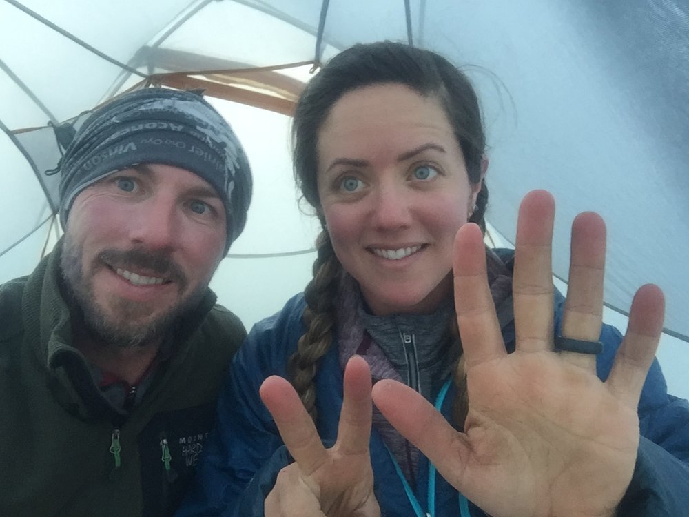
Feeling awesome for about 2 minutes on Blaurock Pass.
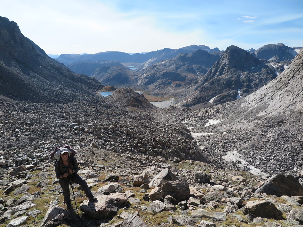
As we crested the top of Blaurock Pass, I expected to feel massive amounts of relief, and I did, for about 2 minutes – until I looked down Blaurock pass and then over to West Sentinel Pass, our next objective. I checked the map again and looked at the route to West Sentinel Pass, “That seriously cannot be right.”, I incorrectly thought to myself. Because, of course, it was right. As I looked at what amounted to the messiest, steepest, most impossible looking heap of jumbled rocks I have ever seen, I couldn’t even bring myself to tell Aaron where we were headed. Instead, I turned my efforts on safely descending Blaurock Pass. I must have been somewhat distracted by my anxiousness, because I clumsily took a step onto a loose rock, which instantly tumbled. Without having a chance to react, I went flailing to the ground – my hiking pole became stuck in a rock and subsequently jabbed me in the gut. My wrist burned from the landing, and I was shaken and stunned as Aaron rushed to my aid – he helped me up, and I assessed myself for serious injuries. When I determined that I was indeed entirely intact, we continued down – albeit, a bit more cautiously this time.
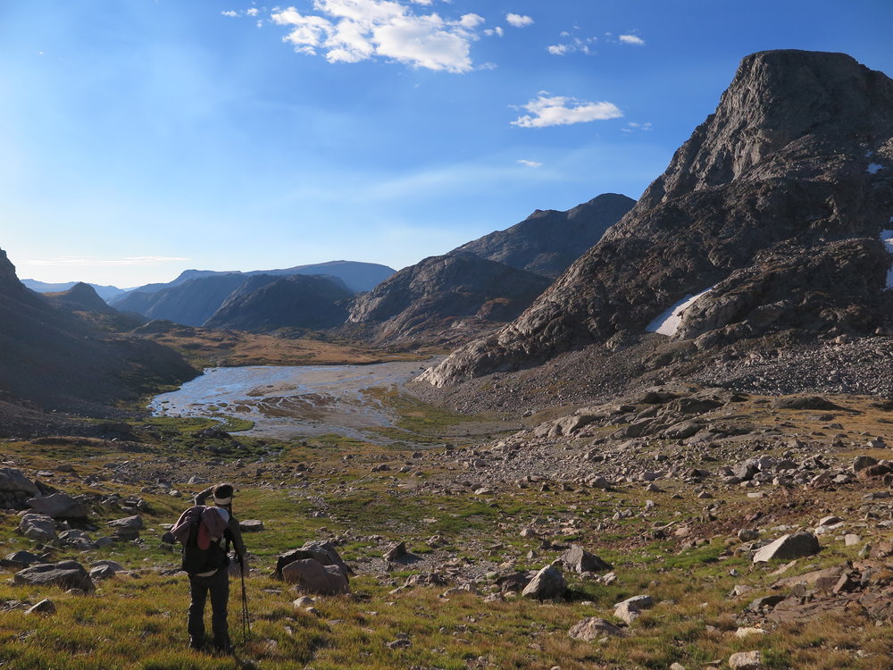
Heading down the Blaurock Pass, en route West Sentinel Pass. The route goes up the massive moraine in front of me and makes a right up the gully visible below Gannett Peak (the domed peak with snow on the top).
The disappointing part about climbing Blaurock Pass is that you ascend a brutal 2000′, only to depressingly lose all of that elevation on the other side. The other important aspect of the descent from Blaurock Pass is that it intersects the “Glacier Trail” at the bottom of the valley. This is a notable point on the high route, because it is the start of the final, most exposed section of the trip, “The Continental Crux”. It is also the last place where it is reasonably possible to “bail” and hike back to the car.. Once you are on the Continental Crux section, it is extremely committing, with no good “bail” options – except to finish the route.
On day one (waaaaaaaaay back at Marm’s Lake), I got goosebumps reading the description of the Continental Crux section to Aaron. I imagined what it would feel like to make it to this point on the route, and the reality that we were here was starting to hit me – and slightly terrify me. Skurka appropriately starts his description of this section with a Theodore Roosevelt quote (note: Skurka gets 500 bonus points for quoting T.R.), “Nothing in the world is worth having or worth doing unless it means effort, pain, difficulty… I have never in my life envied a human being who led an easy life. I have envied a great many people who led difficult lives and led them well.” Skurka then goes on to describe why he considers this section the “crux” of the entire high route, “It’s committing: there are few opportunities to get down or bail out, and none of them are easy. It’s high: the route remains above 11,000 feet for about 18 miles, stays atop the Continental Divide at over 12,000 feet for five consecutive miles… It’s exposed: there is barely a willow cluster for the first 20 miles, nevermind a tree. And finally, it’s very rugged: there is an abundance of rocks, snow and glacial ice, and no trail until the final 7.5 miles.” An abundance of rocks? Oh, good – I can hardly contain my excitement!
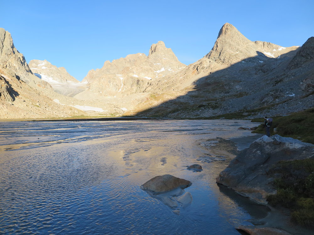
Beautiful little tarn before our junction with the Glacier Trail.
As we reached the base of the descent from Blaurock Pass, we encountered a group of three climbers taking a lunch break – after the standard questions were addressed (namely they wanted to know, “Where the heck did you two come from??”), we exchanged stories about our respective adventures. While we were talking, I looked to my right – the Glacier Trail was sitting there, in all of its simple, appealing trail-deliciousness. No rocks to step over – mindless, brand-numbing hiking sounded like a delicacy right now. How easy it would be to pop on the trail and hike back to the car – heck, we could be having a burger in town and sleeping on a real mattress in no time. I glanced to my left and saw rocks. Piles of rocks. Massive boulders the size of small houses. The messiest, gnarliest terminal moraine that we had encountered so far. The “route” (if you could call it that) up to West Sentinel Pass looked daunting and, naturally, impossible. But Aaron and I hadn’t come this far to call it quits – before I could fantasize too much about a burger and a bed, we said goodbye to the climbers and we turned left and headed into the rocks.
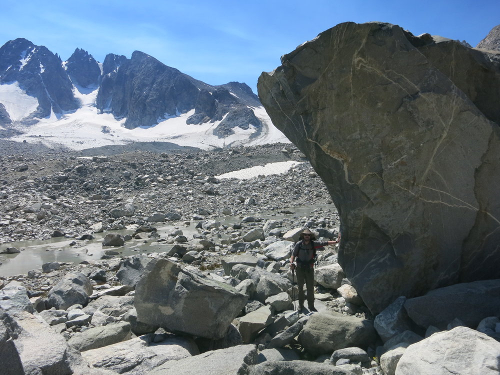
Starting up the moraine towards West Sentinel Pass. Dinwoody Glacier in the distance.
There were some decent sized rocks along the way.
The massive boulders eventually gave way to a gravel-esque trail on the left side of the terminal moraine leading towards the pass. As we ascended, I felt a small twinge of relief – the route wasn’t nearly as awful as I thought it would be, and we were making good time. Suddenly, something caught Aaron’s attention and he called me over to look at a rock. Nestled amidst the (literally) millions of rocks, he had spotted a grey rock that was filled with golden cubes. Excitedly, we both sat down and chipped away at the rock a little bit – the perfectly square cubes easily fell out of the rock and we were completely absorbed and awestruck by our tiny mining operation. For about a half an hour we sat in the terminal moraine, completely transfixed by the rocks. We nibbled on food, sipped on our water, and by the time we decided to start hiking again, we both felt a renewed sense of purpose and energy. Looking back on this break, we both reflected on what a difference it made, both physically and mentally. I couldn’t help but notice that in a place like the Wind River Range, where everything is so tremendously big and vast – there is just as much magic and beauty in the small things as well.
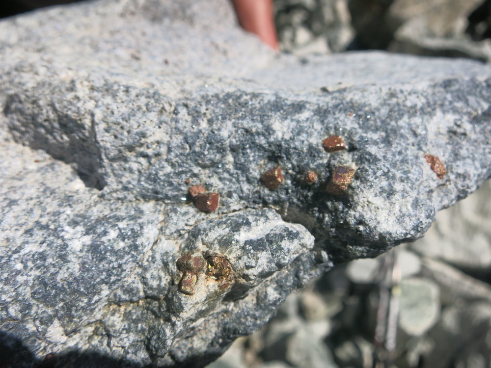
Little pyrite cubes.
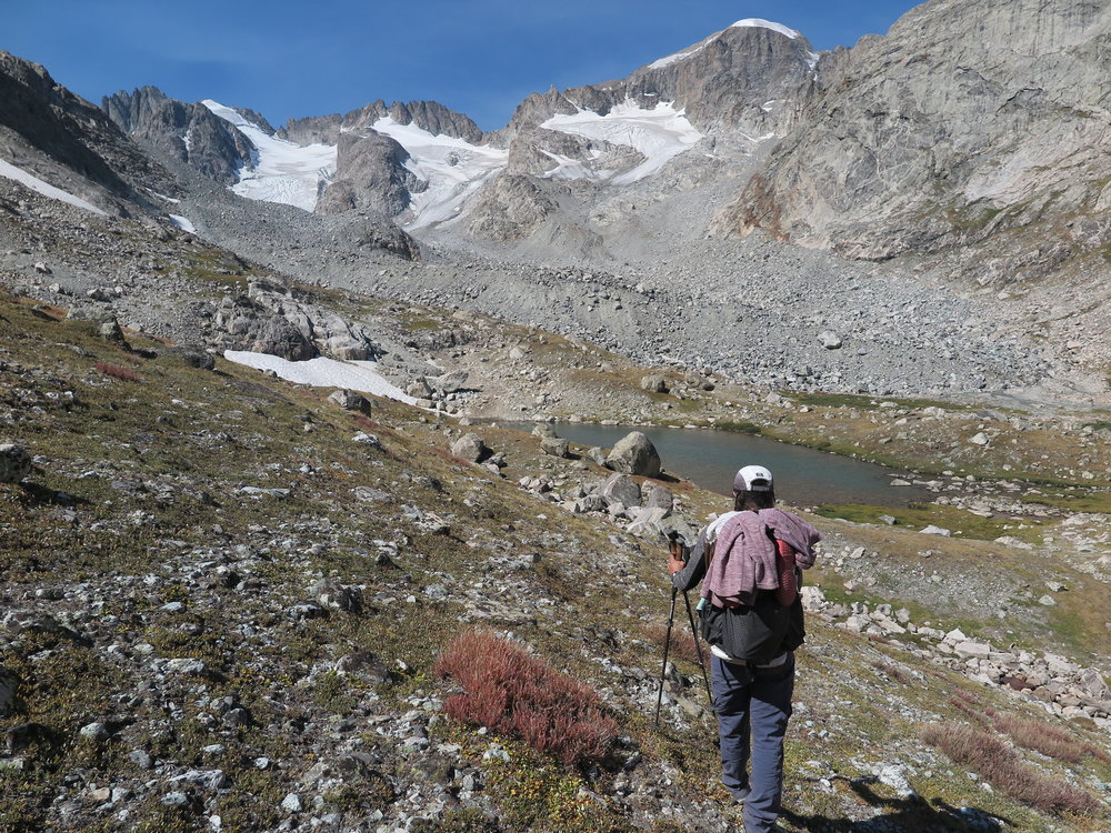
One of the nicer sections heading up to West Sentinel Pass.
Upon reaching West Sentinel Pass, we had the opportunity to cross the Gannett Glacier. As mountain climbers, the thought of crossing a glacier was not uncomfortable – in fact, we were both ecstatic for this section of the route because we knew that it would be easy travel on snow. We slipped on our microspikes for traction and started off on the glacier. It was a warm day, so there was a lot of melting water rushing down the glacier, which made the experience that much more interesting and exciting. Having a break, even a short one, from the never-ending rock scrambling was like a small slice of heaven. Everything, and I mean absolutely everything, seemed magical. Our legs uttered silent, “thank you’s” as we walked, virtually obstacle free, across the ice. The other thing that struck me about this particular landscape was that it was unbelievably desolate – even the towering mountains in the distance had nary a tree or a hint of green anywhere. We had entered a two-toned world of rock-colored and snow-colored. The blisteringly bright blue of the sky was a stark contrast to the somewhat sepia landscape that we were now immersed in.
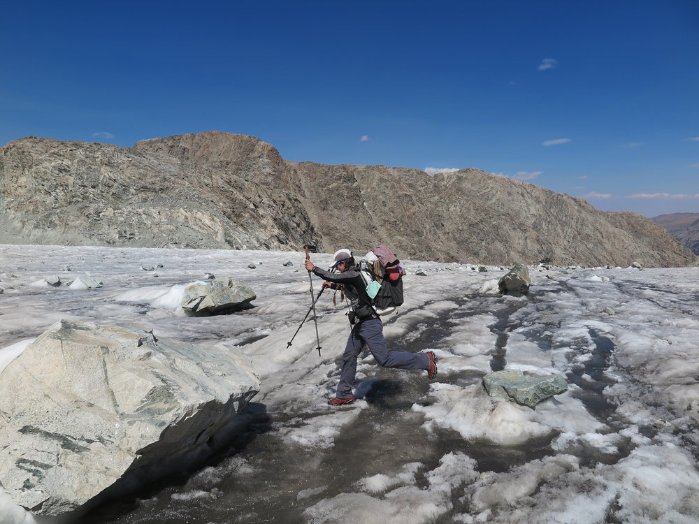
Leaping over some glacial “rivers”.
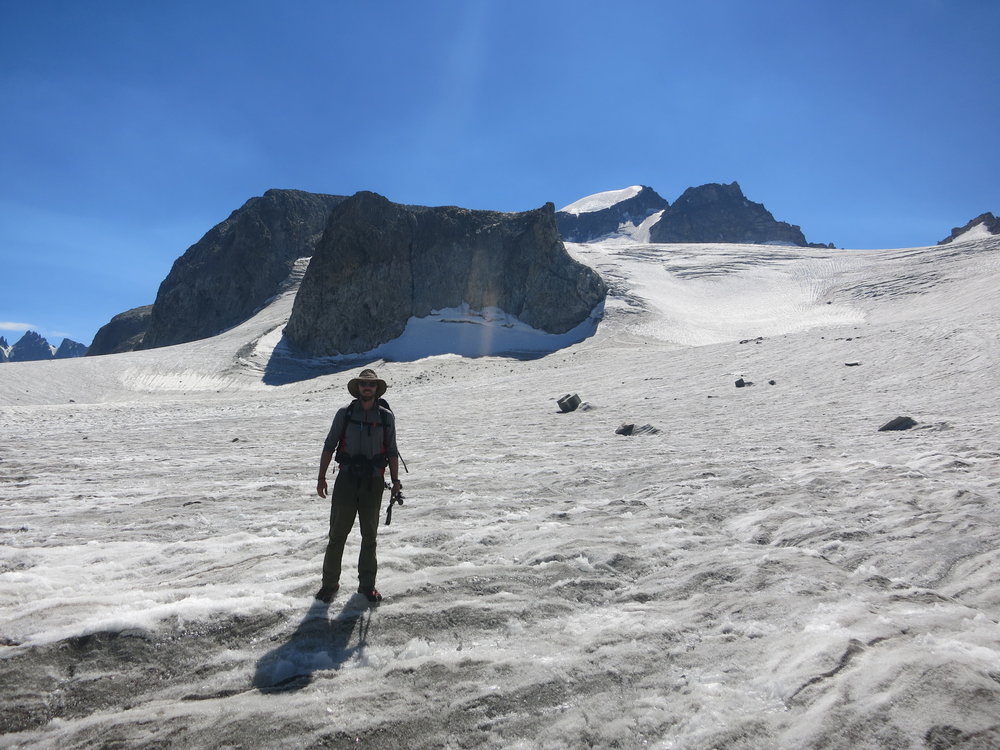
On the Gannett Glacier, below Gannett Peak.
After a quick crossing of the Gannett Glacier, we had to ascend another steep gully, and then (naturally) we had to descend the opposite side of that gully into the biggest cluster of rocks I have ever seen. I know that I previously (incorrectly) reported that the terminal moraine leading to West Sentinel Pass was the, “messiest, gnarliest” moraine I had ever seen. I wasn’t lying when I wrote that, or when I thought that – but I had also not seen this moraine yet, and so I didn’t have anything more horrendous to compare it to. Descending the gully was essentially a controlled fall, intermingled with moments of “less than controlled” sliding. We were like baseball players, sliding to tag a base, except that we were also carrying heavy packs and the baseball field was tilted at a 30 degrees angle. Needless to say, it was a tedious descent.
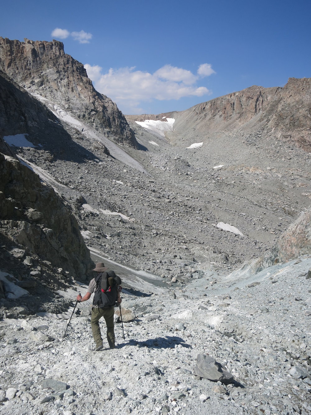
Beginning the steep descent from the gully. Our next objective is that ice patch in the distance below the horizon.
If the descent down the gully was “tedious”, then the next hour or so of picking our way through the moraine basin that lay ahead can only be described as, “THE WORST PART OF THE ENTIRE ROUTE.” Ok, I jest, but this section was extremely mentally and physically exhausting. To describe it in laymans terms: It was slightly more complicated and stressful than navigating a Costco parking lot on a holiday weekend. We had spent the majority of the day so far (over 8 solid hours) carefully walking on every variety of rock in existence. As we picked our way through this next section, at least once, I recall myself specifically saying, “What a garbage pile!”. In retrospect, this was very harsh language – the area is stunningly beautiful, and in no way even close to looking like a garbage pile. However, if the mountains were able to puke up rocks, I imagine that this is what it would look like. As we meandered through the heaps of boulders we saw a few things that motivated us – first, we saw a footprint. This may not seem like a big deal, but it is easy for an area like this to be extremely nerve wracking due to constant doubt about route selection. This section was so challenging that it was quite easy to convince yourself that you must be, “off route”, because really, that seemed like the only possible justification for wandering through such foreboding terrain. Seeing a footprint meant that we were at least on the right track, and if we weren’t, at least there was somebody else lost – and hopefully we would come across them and/or the remains of their body as reassurance. Secondly, we were delighted by the most beautiful, turquoise tarn that I have ever seen. Nestled in the viciously cruel terrain, was a tiny gem of blue water that glistened and twinkled in the sun – reminding us that even amidst the harshness of this environment, there was a certain softness still present in its beauty.
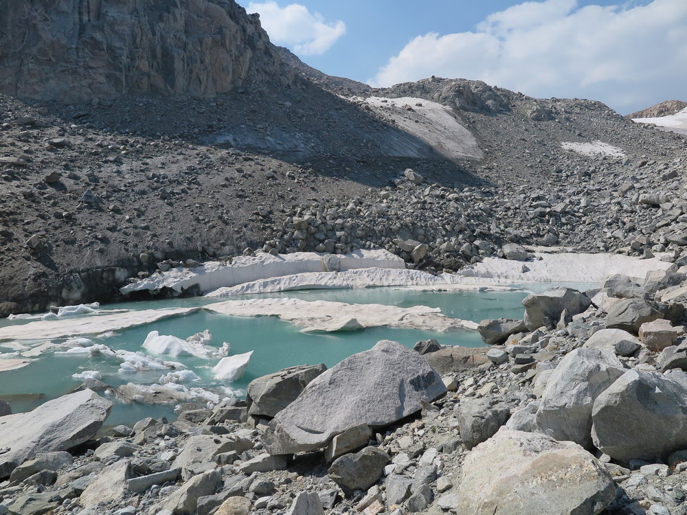
Blue, milky glacial beauty.
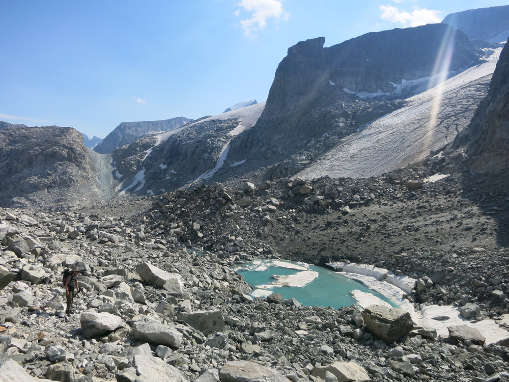
A turquoise diamond in the rough. The gully we descended is visible in the background.
After picking our way through the jumbled rocks for over an hour, we mercifully arrived at a semi-steep ice slope. We strapped on our microspikes, and quickly ascended into a flat area, completely comprised of approximately 400,000,000 rocks. It was nearing the end of the day, and we were anxious to find a campsite. Amazingly, amidst the sea of boulders, we found one patch of sand that was the perfect size for our tent. After setting up, we quickly went to work taking care of our chores for the evening – treating water, bathing and making dinner. As we sat, nibbling on our hot curry, we laughed and reminisced about the day. We were both thrilled with our forward progress, and we had made it further than we expected. I’m not sure exactly why it happened, but at some point, I looked at the mountains towering around us – I realized where we were – and I was hit, unmistakably, by one thought: We’re going to make it. Every shred of doubt that I had been carrying or worrying about – they were instantly washed away and replaced by an overwhelming sense of accomplishment. As I tried to express what I was feeling to Aaron, I broke down in a laughing fit of tears, “I’m crying!”, I tried to tell to him amidst my laughing, “Don’t you see? We’re doing it – and we’re going to make it!” I tried to explain what this meant to me, but I simply couldn’t find the words. The year of planning and dreaming, the exhausting physical training…the days, hours and miles of hiking. The endless rocks. The exhaustion and fear. The happiness and exhilaration – and having somebody to share those experiences with… the moment of decision to turn back or continue on into the unknown – the culmination of all these thoughts had somehow picked this exact moment to strike. And so, while stuffing a chocolate peanut butter cup into my mouth, and sitting next to my husband after 7 days of the most physically and emotionally taxing hiking that I have ever completed in my life, I buried my head into my hands, and I wept for joy.
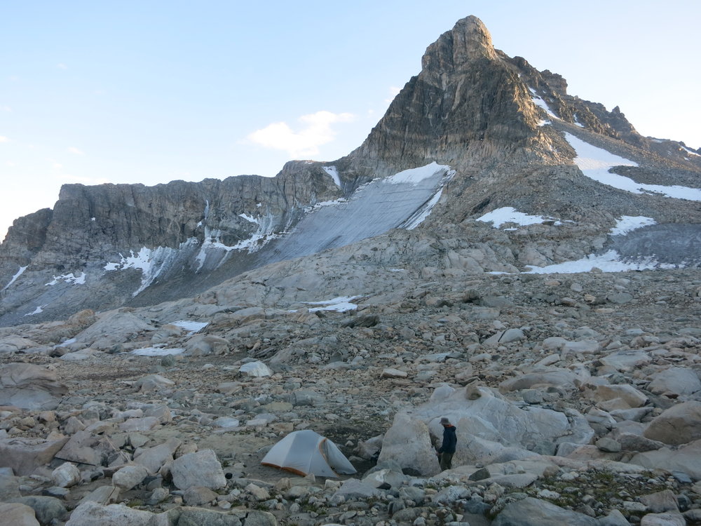
Our campsite on night 7.
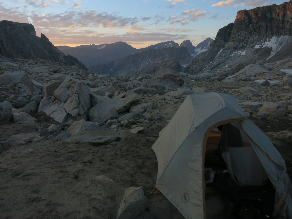
Goodnight, Winds.
Mom
Posted at 00:17h, 31 OctoberOk, I read it before I watched game 4 of the World Series. It made the professional athletes look like weak babies….that make millions of dollars. You and Aaron challenge yourselves for the love of the adventure and your payment is the experience of sharing this accomplishment together. Awesome story.
Aaron
Posted at 01:48h, 31 OctoberThough if someone offered me millions of dollars I might take it, lol
Diana
Posted at 14:54h, 31 OctoberDid Aaron know what he was getting into when he married you?!? That’s love, Anastasia, that’s love.
Anastasia Allison
Posted at 15:46h, 31 OctoberSo, according to Aaron, he had a ‘pretty good idea’ by then what he was getting into. However, I had not yet planned the Wind River High Route in its entirety at the time of our marriage. Yah, I’m pretty lucky!!
Ralph
Posted at 05:36h, 10 NovemberLoved it!
Marge
Posted at 21:19h, 12 NovemberFour months shy of 70 years old, I’m finally getting around to reading Seven Summits by Dick Bass, et all. I must say that I am enjoying your Wind River blog just as much; I am right there with you. Two "quotes" in the Seven Summits made me think of you. One–What we gain too easily, we esteem too lightly. Two–There is a dual path between giving it my all versus giving in. Thanks for sharing your adventure.
Marge